Airborne Research Platforms for Science & Discovery
AeroLabs provides aircraft, mission integration, engineering, logistics, and operational support for airborne scientific research — supporting U.S. Government, university, research institution, and commercial science missions across a broad range of disciplines.
A Full-Service Airborne Science Partner
Airborne science missions require more than an aircraft. They require a partner who understands the intersection of aviation operations, scientific instrumentation, mission planning, and the unique requirements of research campaigns conducted from altitude.
AeroLabs provides the aircraft, mission integration capability, engineering support, logistics, and operational expertise to support the full lifecycle of an airborne science campaign — from initial mission planning through to data collection and recovery.

Airborne Science Capabilities
Heliophysics & Space Weather
Airborne platforms provide unique access for heliophysics research enabling solar observation, space weather monitoring, and eclipse science from above cloud cover and atmospheric interference. AeroLabs supports heliophysics campaigns requiring precise positioning, telescope integration, and real-time telemetry.
- Total solar eclipse observation
- Solar corona imaging
- Space weather monitoring
- Ionospheric research
- Magnetospheric studies
- Solar irradiance measurement
Earth Science
Earth science missions from airborne platforms provide high-resolution data on surface features, land use, vegetation, hydrology, and geological processes. AeroLabs supports earth science campaigns for government agencies, research institutions, and environmental monitoring programs.
- Land surface characterisation
- Vegetation and biomass mapping
- Hydrological monitoring
- Geological survey
- Coastal and marine observation
- Cryosphere research
Atmospheric Science
Atmospheric science research from airborne platforms enables in-situ measurement of atmospheric composition, dynamics, and chemistry at altitudes and locations inaccessible to ground-based instruments. AeroLabs supports atmospheric sampling, trace gas measurement, and aerosol characterisation campaigns.
- Atmospheric composition sampling
- Trace gas measurement
- Aerosol characterisation
- Cloud physics research
- Boundary layer studies
- Air quality monitoring
Astrophysics & Airborne Astronomy
Airborne observatories provide access to infrared and submillimetre wavelengths blocked by atmospheric water vapour at ground level. AeroLabs supports airborne astronomy campaigns requiring telescope integration, stabilised platforms, and high-altitude operations.
- Infrared astronomy
- Submillimetre observation
- Stellar occultation
- Planetary atmosphere studies
- Cometary observation
- Transient event observation
Remote Sensing
Airborne remote sensing provides high-resolution, flexible coverage for a wide range of applications from precision agriculture and forestry to infrastructure monitoring and disaster response. AeroLabs supports multi-sensor remote sensing campaigns with flexible payload integration.
- Multispectral and hyperspectral imaging
- LiDAR and terrain mapping
- Synthetic aperture radar
- Thermal infrared imaging
- Precision agriculture surveys
- Infrastructure monitoring
Environmental Monitoring
Airborne environmental monitoring supports rapid assessment, ongoing surveillance, and scientific study of environmental conditions across large areas. AeroLabs supports environmental monitoring campaigns for government agencies, research institutions, and environmental programs.
- Wildfire monitoring and mapping
- Flood and disaster assessment
- Oil spill detection
- Pollution monitoring
- Ecosystem health assessment
- Climate change research
Sensor & Instrument Testing
Airborne platforms provide a controlled, repeatable environment for testing and validating new sensors, instruments, and measurement systems prior to deployment on satellites or in operational programs. AeroLabs supports sensor testing campaigns requiring flexible payload integration and defined flight profiles.
- Sensor calibration and validation
- Instrument performance testing
- Algorithm development support
- Satellite sensor validation
- Technology readiness advancement
- Comparative measurement campaigns
Technology Demonstration & TRL Advancement
Airborne flight testing provides a cost-effective path to advance technology readiness levels for new systems, sensors, and mission concepts. AeroLabs supports technology demonstration campaigns for government programs, research institutions, and commercial developers.
- TRL advancement campaigns
- New technology demonstration
- System integration testing
- Concept validation flights
- Government program support
- Commercial technology testing
Full Mission Support
AeroLabs provides end-to-end support for airborne science campaigns.
Mission Planning
Campaign design, flight profile development, airspace coordination, and mission documentation.
Payload Integration
Instrument installation, interface engineering, power and data systems, and pre-flight testing.
Flight Operations
Qualified flight crew, mission specialists, real-time data monitoring, and in-flight support.
Logistics & Deployment
Equipment transportation, field deployment, international operations, and recovery logistics.
A Commercially Accessible Airborne Research Platform
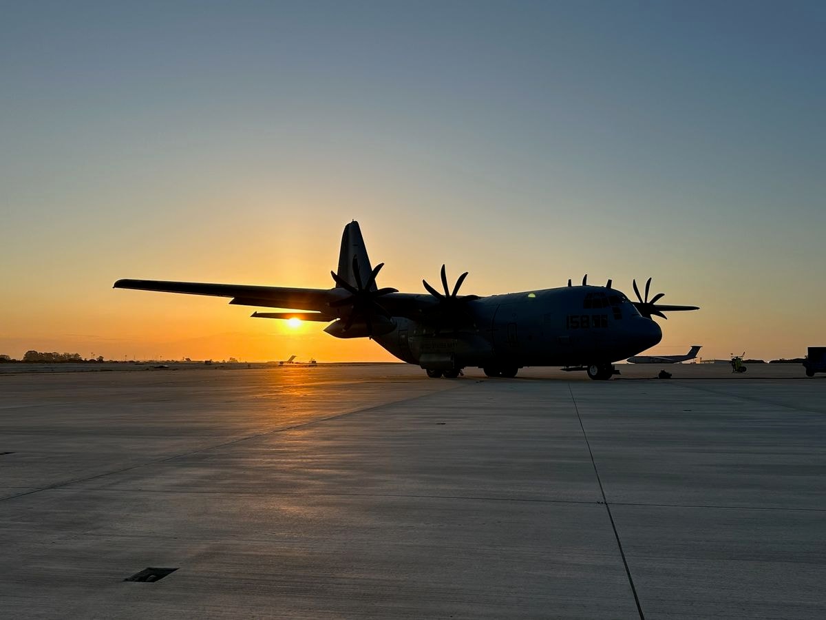
Through the ASCENT Airborne Science Program, AeroLabs is developing a commercially accessible airborne research capability based on the C-130J-30 Super Hercules — providing modular scientific payload capacity, onboard researchers, telemetry, and onboard data processing for the broader science community.
Plan Your Research Campaign
Contact AeroLabs to discuss your airborne science requirement, research campaign, payload, or mission concept.